Why New Fault Data Is Changing How LiDAR Mapping Is Used
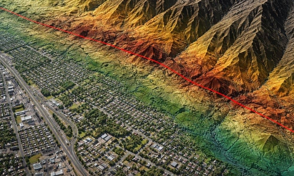
Land development in Provo has always required careful planning. However, recent updates to Utah’s fault data are changing how developers evaluate land risk. What once looked like stable ground may now raise new questions. Because of this shift, more developers are turning to lidar mapping Utah projects early, not later, in the planning process. This […]