A topo survey might not be the first thing people think of when planning a build in Lehi, but skipping it is one of the most common and expensive mistakes. Whether you’re putting up a new home, adding a garage, or shaping the land for something bigger, ignoring what’s beneath your feet can lead to major problems.
What Exactly Is a Topo Survey?
A topo survey (short for topographic survey) is a detailed map of your land. It shows natural features like hills, slopes, and low areas, as well as man-made elements like fences, driveways, or existing buildings. Most importantly, it includes elevation data, a key detail that affects everything from drainage to foundation design.
Surveyors use tools like GPS, drones, and total stations to collect precise information about your property. In places like Lehi, where terrain changes quickly from flat to steep, having this data can make or break a project.
When There’s No Topo Survey, Problems Add Up
Building on a piece of land without knowing its shape is like trying to hang shelves in a crooked room. You can try to make it work but you’ll probably have to redo a lot along the way.
Here are some common problems that happen when there’s no topo survey to guide the project:
1. Drainage That Doesn’t Work
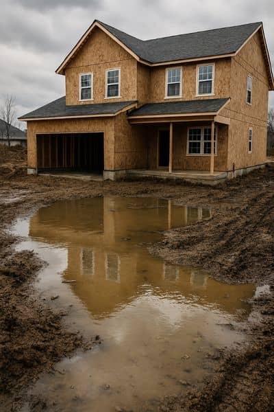
If the land isn’t graded properly, water will go where you don’t want it like under your foundation or pooling near your yard. In Lehi, spring runoff and summer thunderstorms can turn poor drainage into a real mess.
2. Foundations That Don’t Fit
If builders assume the ground is flat but it actually slopes, the foundation can end up off-level or unstable. Fixing that mid-project means rework, extra materials, and added labor costs.
3. Unexpected Earthwork
Without a topo survey, there’s no clear plan for how much soil needs to be moved. That means more equipment time, more fuel, and more days on site all unplanned.
4. Hidden Site Challenges
Large rocks, sudden drops in elevation, or old utility lines can stay hidden until the digging begins. At that point, solving the problem gets expensive fast.
How a Topo Survey Prevents These Mistakes
If you’re planning to build, a topo survey gives you a better understanding of the land so your design works with the terrain not against it and helps you avoid costly surprises later.
So how does it do that? It’s not just a piece of paper. It’s a powerful tool that keeps your project on track.
It Tells You What’s Really Going On
A topo survey shows the full shape of your property not just what you see at a glance. In Lehi, where lots can look flat but hide dips or slopes, that kind of detail helps you avoid making decisions based on guesswork.
It Helps You Plan Smarter
With the full topography mapped out, architects and engineers can design to match the land, not fight it. That means fewer surprises during the build, better drainage, and a foundation that fits the site the first time.
It Cuts Down on Budget Surprises
When you understand the grade of your property up front, you can plan for excavation, fill dirt, retaining walls, and drainage correctly. That prevents costly last-minute changes that can send your budget off the rails.
It Speeds Up Permits and Approvals
In many parts of Utah County, including Lehi, topo surveys are required for building permits especially when grading or stormwater plans are involved. Having one in hand helps get approvals faster and shows the city your plans are solid.
A Real-Life Example From Lehi
A recent build in a Lehi neighborhood hit a major delay when crews discovered the backyard had a steeper slope than expected. Without a topo survey to guide them, they had to stop construction, bring in engineers, and redesign the drainage plan. The total cost? Over $8,000 in delays, equipment time, and material changes.
If they had started with a topo survey, the slope would’ve been factored into the design from the beginning saving money, time, and frustration.
When Should You Get a Topo Survey in Lehi?
The best time to order a topo survey is before the design process begins—ideally, right after purchasing the land or finalizing the site location. It’s especially important if:
- You’re building on a slope or near a hillside
- You need to regrade or move soil
- You’re installing a drainage system
- You’re submitting building plans to the city
- You’re adding a structure like a detached garage or shop
Basically, if dirt is getting moved or anything is getting built it’s time for a topo survey.
Lehi’s Terrain Isn’t Always Predictable
From the foothills near Traverse Mountain to the flatter areas west of I-15, Lehi’s landscape can vary wildly. What looks simple at first glance can reveal tricky slopes, uneven corners, or buried features you didn’t expect.
In Utah County, having accurate topographic survey services makes all the difference in planning a smooth build. Knowing exactly what the land looks like helps avoid surprises down the road. Topo surveys give you a full, clear view of the land before construction starts not after it goes wrong.
Is a Topo Survey Worth the Cost?
Here’s the honest truth: a topo survey typically costs between $800 to $2,000, depending on the size and complexity of the property.
That might sound like a lot up front, but compared to fixing foundation issues, hauling extra dirt, or redoing drainage systems? It’s nothing. In fact, it often saves ten times that amount by preventing mistakes and keeping your project moving.
Build Right From the Ground Up
In Lehi, where no two lots are the same, a topo survey isn’t just helpful it’s essential. It gives you a clear picture of the land, helps your design team plan smarter, and keeps costly surprises from creeping up halfway through the build.
So before the concrete pours, before the grading starts, and before that first shovel hits the ground get the topo survey done. It’s the foundation for everything else.
