Utah landowners have a new reason to double-check their property lines. After the U.S. Supreme Court refused to hear the Wyoming corner-crossing case, the 10th Circuit Court’s ruling now stands—and that includes Utah. The decision has everyone from hunters to developers debating where public access ends and private ownership begins. For anyone buying, selling, or building land, this moment highlights why an ALTA Land Title Survey isn’t just a formality anymore—it’s protection.
When Boundaries Become National News
The term “corner-crossing” sounds harmless, but in real estate it’s explosive. It happens when someone steps from one piece of public land to another at a single shared corner—without touching private ground. To hikers, that sounds fair; to landowners, it can feel like trespassing.
By declining to hear the case, the Supreme Court left the 10th Circuit’s decision in place. That means in Utah, “no-ground-contact” corner-crossing isn’t a criminal act. Overnight, the corners that mark where private and public lands meet became the most talked-about points on a map.
For property owners, this news means your corners must be exact. If your land borders state, BLM, or HOA-managed space—as many parcels around Herriman do—you need clear evidence of where your ownership begins and ends. And that’s where an ALTA Land Title Survey steps in.
The Only Map That Holds Up in Court
An ALTA Land Title Survey is not your average property map. It’s the national gold standard used by title companies, banks, and attorneys to verify the true limits of ownership. Every line, monument, and easement on it ties directly to public record and field evidence.
When a surveyor performs an ALTA, they don’t guess where the boundaries might be. They locate the original monuments, compare them with recorded plats, and show every easement that could affect access or development. If a corner monument is missing, they’ll re-establish it according to strict legal standards—so there’s no argument later about “whose fence is right.”
Now that Utah’s corner-crossing debate has blurred the idea of property access, those legal corners have never mattered more.
Why the Ruling Hits Home in Herriman
Herriman has grown faster than almost any city on Utah’s southwest bench. New subdivisions and commercial pads are sprouting beside open tracts and public trail corridors. It’s exactly the kind of place where small boundary mistakes create big headaches.
A homeowner might build a fence that clips into HOA open space. A developer could discover that a monument marking the back corner of a lot is actually several feet off. A utility company might have an easement that crosses an unseen boundary.
When those corners are questioned, city officials or title officers turn to the ALTA survey. It’s the only document detailed enough to show monuments, right-of-way lines, and overlapping parcels on one certified map.
Corners, Easements, and Everything Between
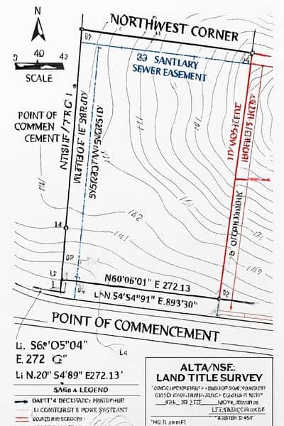
One reason ALTA surveys matter so much right now is how they handle corners. Surveyors identify “found” monuments in the field and compare them to the record. If a corner doesn’t match, they note the discrepancy and explain how they resolved it.
They also list gaps, overlaps, and easements that affect the property—especially those that pass through or touch a corner. That’s critical under the new legal landscape. Imagine a trail easement that ends exactly at your back corner. If the coordinates aren’t precise, someone could cross from public to private land without realizing it.
The ALTA map shows those details in black and white. It removes the gray areas that the court’s ruling has exposed.
The Herriman Growth Factor
Herriman’s recent zoning amendments and the Crescent Commercial MDA plan are expanding development toward areas once surrounded by open land. As those projects move ahead, accurate corner recovery and monument verification protect both builders and investors.
A misplaced monument can delay permits, shift building footprints, or even trigger a title exception. By updating or ordering an ALTA Land Title Survey before grading or financing, owners can avoid disputes later. Survey data also supports clean title insurance—because lenders want assurance that corners and easements line up with the deed.
In short, every new plat, road extension, or trail connection around Herriman depends on trustworthy boundary control.
Table A Items That Matter Now
The ALTA standards include optional details called “Table A Items.” Not all of them apply here, but a few are especially valuable after the corner-crossing ruling:
- Item 7(a): Lists the exact exterior dimensions of structures, useful when buildings sit close to a boundary.
- Item 8 and 9: Confirm whether all corner monuments were found and show any gaps or overlaps with neighboring parcels.
- Item 11: Identifies visible utilities—vital when lines or poles cross at or near a corner.
- Item 16: Notes recent construction or site changes that might affect corner visibility.
Choosing these options helps surveyors and title officers catch access or overlap issues before they become legal trouble.
Why Updating Your Survey Beats Fighting Over One
If your property sits near public or HOA land, now is the time to check the date on your existing survey. Many ALTA maps grow outdated as new subdivisions and infrastructure shift nearby control points. A simple refresh lets a licensed surveyor verify the corners, re-mark monuments, and file the updated record with your title company.
For lenders, this level of accuracy removes exceptions tied to uncertain boundaries. For owners, it prevents “surprise” encroachments or denied permits. It’s far cheaper to update a survey now than to defend a boundary claim in court later.
Don’t Trust the Screen—Trust the Survey
Online parcel viewers and phone GPS apps are handy, but they’re not evidence. Most use aerial imagery with coordinates that can drift several feet. In a state where corner-crossing is legal only if no private ground is touched, a few feet matter.
Survey control points, on the other hand, are tied to the National Spatial Reference System and state benchmarks. That precision separates a legitimate crossing from a trespass.
Three Real-World Scenarios
- The HOA Fence Fix: A Herriman homeowner learns her fence crosses into open space. An updated ALTA survey locates the true monument, allowing her to move the fence and avoid HOA penalties.
- The Trail Easement Discovery: A builder planning a small office park finds that a public trail easement clips the rear corner. The ALTA survey shows the overlap early, letting him adjust the design before city review.
- The Refinancing Win: A landowner near Mountain View Corridor orders an ALTA update. It clears an old title exception about an “uncertain corner,” speeding up loan approval.
Each story has one lesson: clear corners save time, money, and frustration.
Questions to Ask Your Surveyor
If you plan to build, refinance, or sell property touching public or open land, ask your licensed surveyor:
- Have all corner monuments been recovered and marked?
- Are any gaps or overlaps shown on the map?
- Are corner-touching easements clearly labeled?
- Will the survey update be filed with my title company?
Those answers tell you whether your survey truly protects you.
The Bottom Line
The court may have settled the question of access, but it hasn’t changed who owns what. Only an ALTA Land Title Survey defines ownership with the precision that legal boundaries demand.
In a fast-growing city like Herriman, where new development meets open space, that accuracy protects every owner—from small-lot homeowners to large developers. The corner-crossing debate will fade, but property lines remain forever.
If your land borders public, HOA, or undeveloped space, now’s the time to confirm your corners. Order an ALTA Land Title Survey and stay certain about every inch you own.
