flood damage
How an Elevation Survey Predicts Mudslide Risks
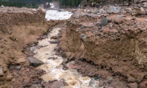
When Provo residents looked up at dark clouds rolling over the mountains this past week, few expected the destruction that followed. A sudden microburst hit
When Provo residents looked up at dark clouds rolling over the mountains this past week, few expected the destruction that followed. A sudden microburst hit
What are FEMA flood maps? FEMA’s Flood Insurance Rate Maps (FIRMs) or just Flood Maps are provided after a flood risk assessment has been completed
Most of you have probably never thought about land surveying until you needed it at some point. Many of us hear about land surveying all