Ogden is changing, and many residents feel uneasy about it. Roads are widening, traffic patterns are shifting, and neighborhoods are adjusting to heavier flow. People are asking if these projects will improve daily life—or make it more dangerous. In the middle of these concerns, one factor matters more than most people realize: a construction survey. It sits quietly beneath every major road plan and affects how safe a community becomes once the work is done.
Over the past few months, residents have raised concerns in community meetings and online discussions. Some worry that cars will move faster near their homes. Others fear that the new lanes will block access to driveways or make crossing the street harder for children. These conversations are happening everywhere—from coffee shops to social media—and many share the same nervous tone.
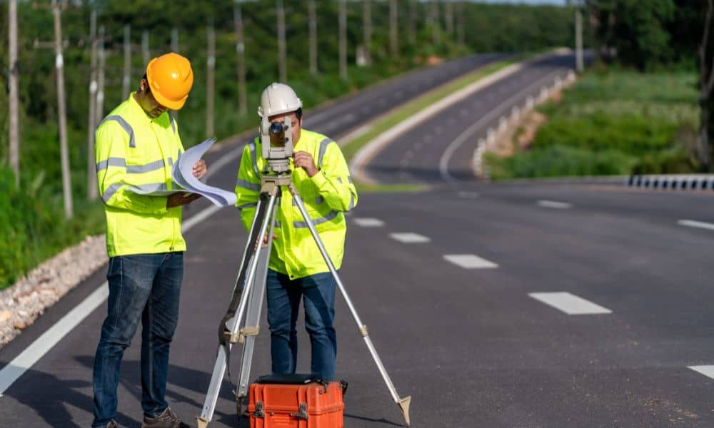
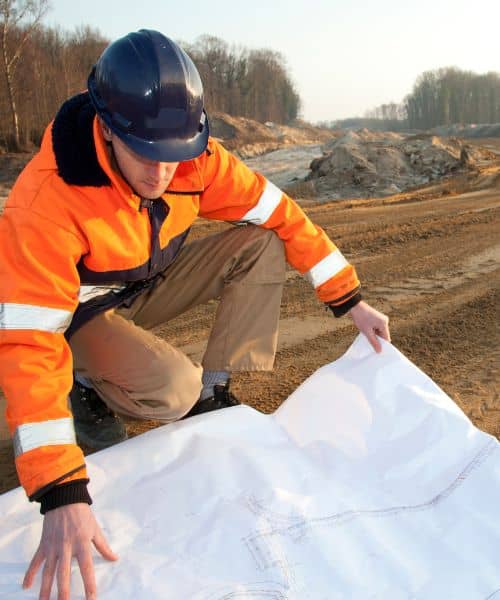
While comments usually focus on drivers and design choices, the truth goes much deeper. Long before a new road opens, crews measure the land, record slopes, confirm drainage pathways, mark utilities, and define the limits of construction. All of that work shapes what we will live with for decades. That is the real purpose of a construction survey: to make sure roads are built with precision, not assumptions.
The Community Concerns Are Rising
When a major road changes, the ripple effect touches everyone. Parents wonder if traffic will speed up near schools. Business owners think about how customers will reach them. Meanwhile, neighbors picture new intersections cutting through their once-quiet routines.
It is easy to overlook the early stages of development, yet that phase has the most influence. Before the public sees machines or barriers, a survey team evaluates the landscape. With every measurement, they set the stage for how the road will function. A single missed detail can affect an area for a generation, especially in a growing city like Ogden.
Why Accuracy Matters More Than People Think

A construction survey sets the foundation for safe road design. Surveyors identify how steep a roadway will be, how water should move away, and how future traffic can flow. Their findings guide where sidewalks end, where shoulders begin, and where turning lanes need more space. When the work is thorough, the design feels simple and natural, even when the terrain isn’t.
These choices shape daily life long after construction wraps up. In growing cities like Ogden, crews often rely on surveying expertise for road projects to understand how the land will behave once cars, water, and weather begin interacting with the pavement. That early insight makes a huge difference, even if the public never notices it happening.
When the groundwork is right, drivers feel comfortable behind the wheel. Roads drain how they should. Intersections flow the way engineers intended. But when the survey phase is rushed, the problems take longer to appear. They start quietly, then slowly grow into the kind of issues everyone complains about later.
Even a small measurement error can lead to constant resurfacing, winter ice patches, or frustrating blind spots. These aren’t the dramatic mistakes you see on opening day—they’re the slow failures that creep in over time, after the earth reveals what the asphalt tried to hide.
What Happens When Surveys Miss Key Details
Life on the road changes the moment something is built in the wrong place. For example, if survey calculations don’t match what crews find on-site, construction teams may adjust work without realizing the long-term effect.
In winter, a shallow dip can freeze into a sheet of ice. In summer, the same dip can trap stormwater. Drivers adapt at first, but over time, the danger becomes obvious. Pedestrians feel it too, especially where crosswalks meet sloped entrances or narrow sidewalks.
Roads are especially vulnerable to these issues because of the terrain. We have hillside streets, angled driveways, and changing elevations in nearly every neighborhood. Survey accuracy keeps these features working with the road, not against it.
The Hidden Impact on Daily Living
When the work is precise, a road becomes part of the landscape. Traffic blends into natural flow. Families cross the street without hesitation. Cars turn safely into neighborhoods without blocking lanes behind them. Drivers stay alert, yet relaxed.
That feeling is not luck. It is the result of data collected months earlier.
As development moves forward, the public often reacts to what they see happening above ground. But the most significant improvements are often the ones they don’t notice at all—because nothing goes wrong. The goal of a proper construction survey is exactly that: invisible success.
Ogden’s Future Depends on What Happens Now
This city is entering the next phase of its expansion. As the population grows, transportation will become one of the most important factors in quality of life. Every new curve, connection, or intersection will shape how residents experience their neighborhoods.
Once a road is built, fixing it becomes harder. That is why early surveying matters so much. It protects residents from living with dangerous designs. It prevents mistakes from turning permanent. It saves future costs that taxpayers would rather avoid.
A construction survey gives a chance to get it right before anything goes wrong.
The Road Ahead
People in Ogden care about safety. They care about their families, their neighborhoods, and their routines. While not everyone knows what a construction survey includes, everyone benefits from its success.
Road safety is not only about paint and pavement. It begins long before a project breaks ground. It begins the moment survey crews map the land.
These early measurements shape everything. They influence the visibility, slope, drainage, and alignment we count on every day. They determine whether a road becomes a blessing—or a burden.
Growth is coming whether we are ready or not. Ogden deserves safer roads, smarter designs, and careful planning. A strong construction survey will help ensure that.
When survey lines are accurate, the city moves with confidence. When they are not, the community pays the price for decades.
Good roads aren’t just built. They are measured into existence.


