Check the Capture Date of Aerial Imagery Before Using It
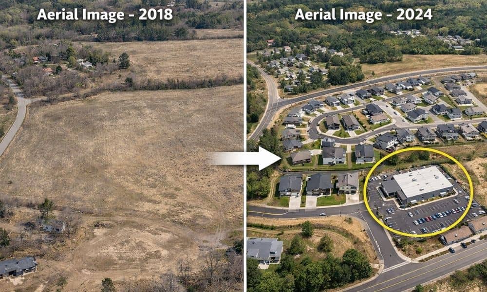
Many people use aerial imagery when they want to learn more about a piece of land. In fact, it often becomes a starting point for aerial imagery for property research, especially when buyers, builders, or property owners want a quick view of the area. At first glance, these images look clear, detailed, and current. You […]