Why New Fault Data Is Changing How LiDAR Mapping Is Used
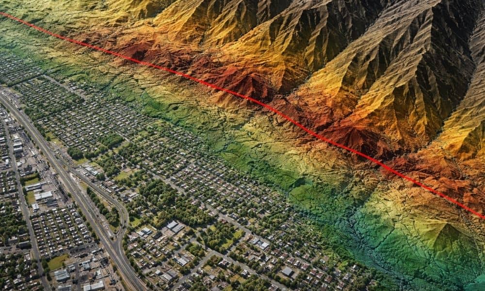
Land development in Provo has always required careful planning. However, recent updates to Utah’s fault data are changing how developers evaluate land risk. What once looked like stable ground may now raise new questions. Because of this shift, more developers are turning to lidar mapping Utah projects early, not later, in the planning process. This […]
How to Prepare for a Title Survey and Avoid Costly Delays
Ordering a title survey may sound easy. You contact a surveyor, they visit the site, and you receive a map. Still, the accuracy of that map depends on what happens long before the surveyor arrives. When documents are missing, access is blocked, or boundaries are misunderstood, the process slows down. Revisions then become more likely. […]
Why Flood Map Updates Trigger Elevation Certificate Requests

If you were recently told you need an elevation certificate, you’re probably confused. Nothing flooded. No storm rolled through your neighborhood. Your home looks exactly the same as it did last year. Yet suddenly, a lender, insurer, or city office is asking for paperwork you’ve never needed before. This is happening across many growing communities, […]