Land development in Provo has always required careful planning. However, recent updates to Utah’s fault data are changing how developers evaluate land risk. What once looked like stable ground may now raise new questions. Because of this shift, more developers are turning to lidar mapping Utah projects early, not later, in the planning process.
This change is not about fear or overreaction. Instead, it is about better information. When the data improves, smart decisions follow.
What changed in Utah’s fault data
Over the past few years, the Utah Geological Survey has refined fault maps across the Wasatch Front. These updates rely on higher-resolution surface data than older studies used. As a result, geologists can now see subtle ground features that point to fault movement.
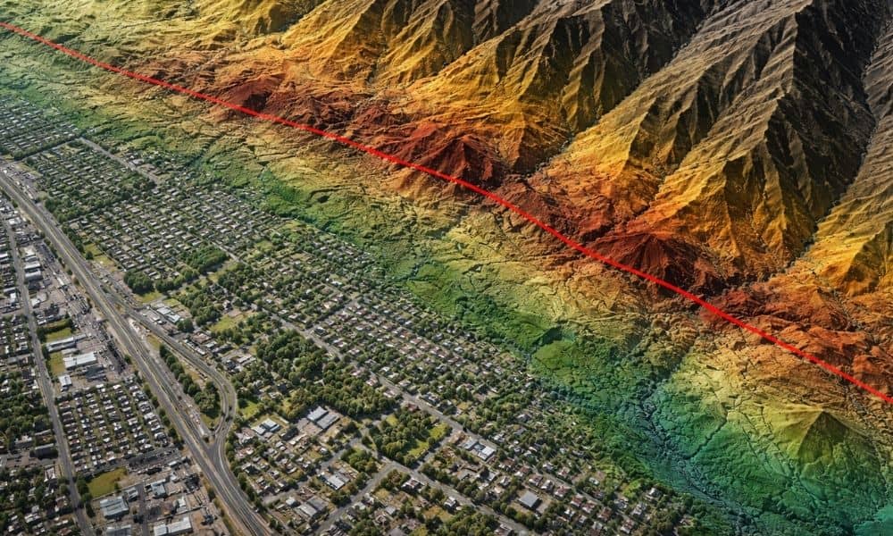
Previously, many of these features blended into the landscape. Traditional mapping tools simply did not catch them. Now, improved elevation data brings them into focus. That shift matters because fault location and behavior influence how land can be developed.
Although these updates apply statewide, areas like Provo feel the impact more strongly. Growth continues along the mountain front, where faults and complex geology are common.
Why developers are paying closer attention
Provo sits in a narrow zone between Utah Lake and the mountains. Because of that geography, developable land often lies close to known fault systems. When fault data changes, assumptions change too.
For developers, this affects more than engineering drawings. It influences land value, site layout, and even project timelines. A parcel that once appeared straightforward may now require additional review. That does not mean development stops. It simply means better planning comes earlier.
In today’s market, surprises cost money. Therefore, developers want clarity before design and financing move forward.
Where LiDAR fits into the picture
This is where lidar mapping work becomes essential. LiDAR allows professionals to see small surface variations across large areas. These variations often reveal fault-related features that are hard to detect on the ground.
Instead of relying on generalized contours, developers gain a clear view of how the land actually behaves. That clarity supports informed decisions from the start.
Unlike older datasets, modern LiDAR captures elevation details at a much finer scale. Because of that, it plays a key role in updated fault mapping and site evaluation.
How updated fault data affects due diligence
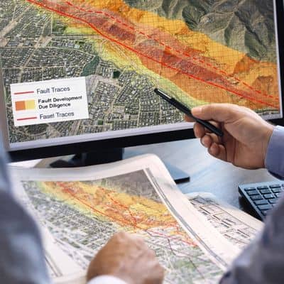
Due diligence used to focus on zoning, utilities, and boundaries. Now, geological context carries more weight. Fault proximity can influence building placement, foundation design, and infrastructure routing.
When developers review land without updated elevation data, they risk missing important constraints. Later discoveries often lead to redesigns, delays, or added engineering costs.
By contrast, early use of LiDAR-based analysis supports smoother approvals. Planners and reviewers trust projects that rely on current, accurate data. Lenders and investors feel the same way.
Why early data matters more than ever
Many development issues surface too late. By the time grading begins, options shrink. Early access to high-quality land data keeps options open.
With lidar mapping Utah, developers can evaluate fault-related risks before committing to a design. That approach saves time and protects budgets. More importantly, it builds confidence across the project team.
As Provo continues to grow, expectations for site data rise. Updated fault information pushes those expectations even higher.
LiDAR supports smarter planning, not extra steps
Some developers worry that LiDAR adds complexity. In reality, it reduces uncertainty. Instead of guessing how land might behave, teams work from clear evidence.
LiDAR does not replace professional judgment. Rather, it supports it. Engineers, planners, and surveyors use the data to make better calls earlier.
When fault data and elevation data align, projects move forward with fewer surprises. That outcome benefits everyone involved.
What this means for future development
Fault-aware planning is becoming standard practice. As data improves, regulators expect developers to respond. That trend will likely continue.
Provo’s location along the Wasatch Front makes this especially relevant. Development will continue, but it will rely more on detailed land analysis.
In that environment, lidar mapping Utah projects move from optional to expected. Developers who adapt early gain an advantage.
A smarter way to manage land risk
Updated fault data does not stop development. Instead, it encourages smarter development. With better information, teams can plan with confidence.
For developers, the message is clear. Early access to accurate land data supports better decisions, smoother approvals, and stronger projects. LiDAR mapping helps make that possible.
As land evaluation standards evolve, those who rely on current data stay ahead. Those who do not often catch up later, at a higher cost.