
Most people think of a licensed land surveyor when something goes wrong. A fence ends up in the wrong place. A neighbor questions a boundary. A closing gets delayed because something doesn’t match.
That’s usually the point where problems are already expensive.
In Ogden, a licensed land surveyor is often involved much earlier than that. Their work shapes how land gets used, approved, and built on. When that step is rushed or skipped, issues don’t show up right away. They surface later, usually during permitting or construction, when changes are harder to make.
This is where most property owners underestimate the role.
Before Design, Before Permits, Before Anything Moves
Plans don’t start on paper. They start with understanding what’s actually on the ground.
Ogden has a mix of older neighborhoods, sloped lots near the foothills, and areas with clay-heavy soil. At first glance, a property might seem straightforward. Once you start looking at elevation changes and how water moves across the site, it usually tells a different story.
A lot of this comes down to timing. Bringing in a licensed land surveyor early gives you a clear picture of the site before anything gets drawn. Without that, designers are working off assumptions, and those assumptions tend to lead to revisions that slow everything down.
In some parts of Ogden, runoff after heavy rain becomes a real concern. If grading plans don’t reflect how water actually flows, it can end up pushing drainage toward neighboring properties. That’s the kind of issue that gets flagged during review or shows up later when it’s much harder to fix.
Why the Paper Record Doesn’t Always Hold Up

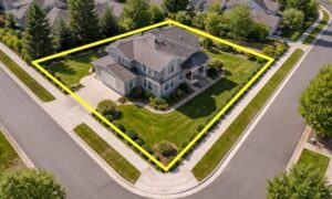
Property records feel official. Deeds, plats, and county maps all look clean and precise. The problem is that the ground doesn’t always match those records.
Ogden has areas where older surveys were done decades ago. Over time, corners shift, markers disappear, and fences get built based on assumptions. Those small differences add up.
A licensed land surveyor doesn’t rely on documents alone. They compare records with physical evidence. Sometimes everything lines up. Sometimes it doesn’t, and that’s where judgment comes in.
This is also where many disputes begin. Not because someone intended to cross a boundary, but because the reference they trusted wasn’t accurate anymore.
Permits Get Delayed for Reasons That Don’t Seem Obvious
A project can look ready on paper and still get held up during review.
In Ogden, permit reviewers look closely at setbacks, building placement, and drainage. All of that ties back to survey data. If the underlying measurements are off, even slightly, it creates inconsistencies in the plans.
Those inconsistencies don’t get ignored. They get flagged.
Once that happens, the project goes back for revision. That can mean reworking layouts, adjusting grading, or even shifting the building footprint. None of that is quick once design work is already done.
A licensed land surveyor helps avoid that situation by making sure the base information is solid before anything gets submitted.
Construction Is Where Precision Becomes Non-Negotiable
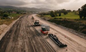
Once a project moves into construction, there’s no room for interpretation. Everything has to be placed exactly where it was approved.
This is where survey work shifts from planning to layout.
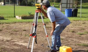
A licensed land surveyor transfers the design onto the site. They mark where structures go, where elevations need to sit, and how everything aligns with property lines.
In tighter parts of Ogden, especially infill lots, there isn’t much margin for error. A small shift in placement can put a structure too close to a setback line or create conflicts with neighboring properties.
Fixing that after concrete is poured isn’t a simple correction. It’s a major problem.
Soil Movement and Slope Add Another Layer
Ogden’s terrain isn’t flat, and the soil doesn’t stay perfectly stable.
Clay-heavy ground expands when it absorbs moisture and contracts when it dries out. Over time, that movement can affect surface features and even older survey markers. Combine that with sloped areas near the foothills, and site conditions become less predictable.
A licensed land surveyor factors in those conditions when collecting data. Elevation points aren’t just numbers on a drawing. They reflect how the land behaves.
That matters when engineers design grading plans or foundations. If the survey doesn’t capture those conditions accurately, the design built on top of it won’t perform the way it should.
Growth in Ogden Is Raising the Stakes
Development in and around Ogden has picked up. More lot splits, more new builds, more pressure on available land.
That growth puts more weight on survey accuracy.
When land gets divided or redeveloped, small errors don’t stay contained. They affect multiple properties, utility placements, and access points. Once those are built, correcting them becomes complicated.
Newer subdivisions also come with stricter requirements. HOA guidelines, setback rules, and drainage controls all depend on precise measurements. A licensed land surveyor helps make sure those requirements are met from the start.
Timing Changes Everything
Waiting too long to bring in a surveyor creates avoidable problems.
By the time issues show up, designs are already done and schedules are in place. Fixing conflicts at that stage costs more and takes longer.
Early survey work gives a clearer picture of the site before decisions are locked in. It allows adjustments without tearing things apart later.
That’s the difference between a smooth approval process and one that drags out.
Closing Thought
A licensed land surveyor plays a bigger role than most property owners expect. In Ogden, where terrain, soil conditions, and ongoing development all come into play, that role becomes even more important.
Getting accurate information early keeps projects moving and avoids the kind of issues that are hard to fix later. If you’re planning any kind of work on your property, starting with the right data makes everything else easier to manage.