When Ogden City started work on a major water pipeline through Ogden Canyon, most people focused on the big picture: clean water, better access, and modern infrastructure. But beneath the surface of that story was something that doesn’t often make headlines — the crucial role of boundary surveys.
Boundary surveys are the unsung heroes of every public project. They define exactly where public land ends and private land begins. Without them, cities risk legal trouble, project delays, and angry landowners. Ogden’s pipeline project showed just how risky it can be to skip or rush this step — especially in tough terrain like the canyon.
What Really Happened in Ogden Canyon?
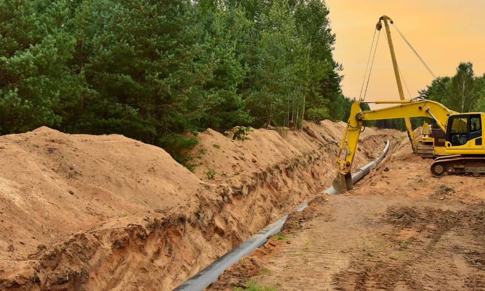
In early 2025, Ogden City bought land in the canyon to create access for a 36-inch transmission water pipeline. This line connects the Pineview Reservoir to the city’s 23rd Street water tanks. Sounds simple, right?
Not quite.
The land purchase was about more than just putting down some pipes. City officials needed to make sure they could legally reach and maintain the pipeline. That meant building new access roads, getting into tight spaces, and even planning for emergencies.
But here’s the catch: in a place like Ogden Canyon, where land is divided into tricky, irregular parcels, that access isn’t guaranteed — unless a solid boundary survey is done first.
Why Boundary Surveys Matter So Much

Imagine buying a piece of land, then finding out later that a road cuts through someone else’s property. Or you start construction, only to get a legal notice saying you’ve crossed a neighbor’s line. That’s what happens when boundary surveys are skipped, outdated, or just plain wrong.
In public infrastructure projects, the risks get even bigger. Cities and contractors can face lawsuits, huge delays, and skyrocketing costs — all because of invisible lines on a map.
Boundary surveys help by:
- Clearly marking property lines.
- Identifying easements (legal rights to use someone else’s land).
- Spotting issues like encroachments or missing records.
- Helping with permits and legal filings.
In Ogden’s case, they needed to be 100% sure the city could legally access and maintain the new pipeline — not just today, but for decades to come.
The Hidden Risks in Places Like Ogden Canyon
Ogden Canyon isn’t your average neighborhood. It’s full of steep slopes, winding roads, and old property lines that go back over a hundred years. That’s where things get complicated.
Here are some hidden risks that boundary surveys help uncover:
1. Lost or Broken Monuments
Monuments are physical markers (like stakes or stones) used to mark property corners. In a rugged place like Ogden Canyon, they can get buried, moved, or lost over time. Without them, surveyors have to dig into old maps — and hope they’re accurate.
2. Outdated Records
Some property lines were drawn when Utah was still a territory. These records may be unclear or based on landmarks that no longer exist. If your project relies on those lines, you’re building on shaky ground — literally and legally.
3. Overlapping Claims
With cabins, trails, and utility lines all crisscrossing the canyon, it’s easy for landowners to accidentally encroach on each other. A well-done boundary survey finds these problems early, before they turn into lawsuits.
What It Means for the Rest of Us
You don’t have to be a city planner to care about this stuff. Whether you’re a homeowner, developer, or land buyer, Ogden’s pipeline project offers a few important lessons:
If You Own Land Near Public Projects
Know exactly where your property lines are. Don’t rely on fences or old assumptions. Get a licensed surveyor to check. If the city needs to cross your land, you should know — and you should be part of the conversation.
If You’re Buying Land
Never skip a boundary survey. Especially in places like Weber County, where terrain and land records can make things messy. A survey can protect your investment — and your peace of mind.
If You’re Building Anything
Before you break ground, confirm the lines. Whether it’s a fence, driveway, or shed, the last thing you want is to move it later (or worse, tear it down).
When Should You Get a Boundary Survey?
While every situation is different, here are a few smart times to get a survey done:
- Before buying or selling land.
- Before starting construction near a property line.
- When dividing land (like in a subdivision).
- If there’s a dispute with a neighbor.
- When applying for building permits or financing.
And in cases like Ogden’s pipeline, a survey is critical before starting any public works or utility project — especially when it affects multiple parcels or runs through tough terrain.
A Bigger Message From a Local Story
Ogden’s pipeline project is a success story — but it also came with lessons. It showed that the smallest details can cause the biggest problems if they’re ignored. In this case, those details were buried under trees, rock, and 100 years of shifting land records.
Boundary surveys might seem boring to some, but they’re the foundation for any project that touches land. Roads, pipelines, fences, even your backyard patio — they all depend on knowing where one property ends and another begins.
So whether you’re a city official planning the next big project, or a homeowner putting up a new fence, don’t skip the survey. In the long run, it saves money, time, and legal headaches.
Final Thoughts
Ogden’s pipeline didn’t just bring water — it brought attention to something many people overlook: the power of good land surveying. In places with challenging geography, boundary surveys aren’t just helpful — they’re essential.
Know your lines. Protect your land. And when in doubt, call a professional.
