Drone surveying is no longer a futuristic tool. In Utah, it’s become part of everyday work for surveyors, builders, and developers. From mapping new subdivisions to checking flood channels along Dry Creek, drones are speeding up projects and delivering accurate data. But big changes are on the horizon. On September 29, 2025, the Federal Aviation Administration (FAA) confirmed that the comment window on its new Beyond Visual Line of Sight (BVLOS) rules will close on October 6. That decision could reshape how drone surveying is done in Utah starting in 2026.
What BVLOS Means in Plain English
Most drone operators today must keep their aircraft in sight at all times. That’s the current rule. But surveyors often need to map large areas—sometimes hundreds of acres—that stretch well beyond what the eye can see. That’s where BVLOS comes in.
BVLOS stands for Beyond Visual Line of Sight. It’s a proposed framework that would allow certified operators to fly drones farther, with the help of advanced systems. The FAA’s draft, known as Part 108, suggests moving away from rigid waivers and toward a performance-based approach. Instead of filing endless paperwork for every project, operators could use approved methods like unmanned traffic management (UTM) systems, detect-and-avoid technology, or third-party monitoring services to stay compliant.
In short, BVLOS could make drone surveying more practical for large-scale projects. But it also raises new questions about cost, training, and equipment.
Why the Oct 6 Deadline Matters
The FAA received pressure from industry groups to extend the comment period. Many surveyors, contractors, and drone operators said they needed more time to respond. On September 29, the FAA said no. The clock is ticking, and October 6 is the final chance for the public to weigh in.
For survey firms, this deadline is critical. Once the rule is finalized, it will determine how crews plan, price, and deliver survey work for years to come. Missing the chance to share local concerns now could leave gaps in the policy that affect mountain valleys, radio interference, or tricky RTK connections that surveyors deal with every week.
Why Surveyors Are Torn
Not everyone in the industry sees BVLOS the same way.
- The optimistic view: Groups like the Association for Uncrewed Vehicle Systems International (AUVSI) believe BVLOS will unlock efficiency. Drone surveying could cover larger sites without stop-and-go resets, and firms could handle more work with fewer field hours. That means cost savings for clients and faster turnaround.
- The cautious view: Smaller operators worry about the price tag. If the FAA requires expensive technology, new insurance policies, or constant third-party monitoring, the benefits could be out of reach for many firms. For local surveyors working on tight budgets, that’s a real concern.
This mix of excitement and fear shows why the Oct 6 comment deadline is so important.
Why This Hits Home

Lehi is growing at record speed. Between Traverse Mountain developments, new commercial hubs around Thanksgiving Point, and ongoing upgrades to I-15, construction is everywhere. Each project depends on accurate survey data.
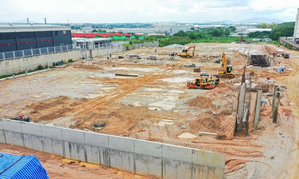
Drone surveying has already proven its value across Utah County. For example, drone LiDAR mapping gives surveyors the ability to capture detailed terrain models, which makes grading plans for subdivisions more precise and reduces costly rework. The same technology also supports progress mapping that keeps contractors on schedule for large office parks, and flood monitoring that ensures channels like Dry Creek can handle heavy runoff.
Without BVLOS flexibility, surveyors must break these jobs into smaller chunks or bring in more crews. That slows down work and increases costs. With BVLOS, one pilot could manage an entire corridor or hillside, reducing delays and delivering results faster.
What Clients Should Know
If you’re a developer, builder, or city planner, the FAA’s BVLOS rule may sound like a distant government issue. In reality, it affects your bottom line. Here’s why:
- Faster surveys mean faster permits. When projects don’t stall waiting for data, construction starts sooner.
- More accurate mapping reduces surprises. BVLOS-enabled flights can cover entire sites in a single run, reducing gaps.
- Lower costs flow to clients. When surveyors spend fewer hours in the field, bids reflect those savings.
Put simply, if your surveyor is prepared for BVLOS, your project benefits.
What Survey Firms Should Do Now
Survey companies should not sit back. The FAA’s comment period is open until October 6, and field-driven feedback is vital. That means pointing out real-world challenges:
- RTK/RTN dead zones in the Alpine–Lehi corridor.
- Signal interference along the Wasatch Front.
- Mountainous terrain that makes line-of-sight impossible without BVLOS.
By submitting these details, surveyors can help shape a rule that actually works in local conditions.
The Bottom Line
Drone surveying has become an essential tool. It saves time, improves accuracy, and keeps projects on track. But the FAA’s BVLOS rules will decide just how far those benefits can go. With the Oct 6 deadline approaching, surveyors and their clients have a narrow window to make their voices heard.
For developers, the takeaway is simple: ask your surveyor how they’re preparing for BVLOS. A firm that plans ahead can deliver results faster, at lower cost, and with fewer headaches down the road.
